Silchester digital surveying trials
Today the VERA team visited the Silchester site with some guys from Infoterra to try out some digital data-capture techniques which may be used in the coming summer excavation.
The goal of the day was to see the high-tech tools Infoterra uses in action and to work out if we could use them in the summer ourselves. One of the main goals of VERA is to streamline the capturing of data and get it into the IADB, we hope that digital surveying equipment will help us do that.
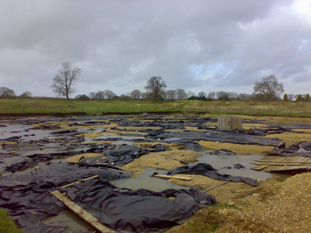
In what is becoming traditional Silchester weather, we got a bit damp while on site, but managed to use the more sensitive equipment before the heavens gates opened. This picture shows the trench which is covered by back-fill and tarps to protect it. Amanda assures me that it looking a bit like a sad swimming pool is perfectly normal for this time of year.
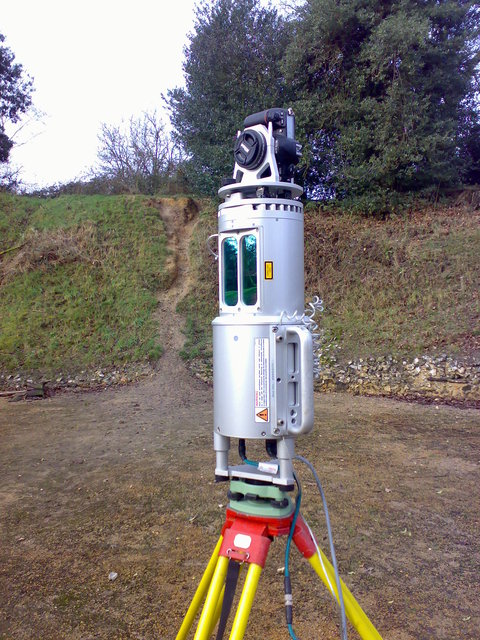
We used LIDAR to create a 3D image of the Roman amphitheater to the south of the trench. A rotating laser creates a wire-frame image of the surroundings by continuously sampling the range to anything the laser strikes. A digital camera fixed to the top takes images which can be mapped onto the wire-frame to create a 3D picture. The 3D images look awesome and the resolution can up as fine as 2mm so the data can be used to look at scenes in detail.
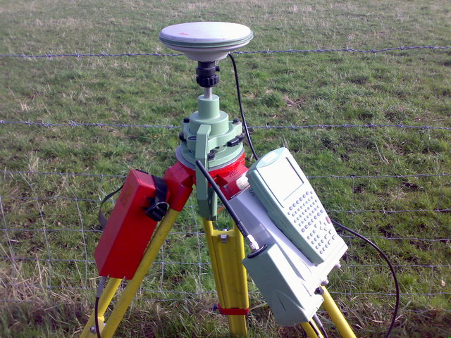
This picture shows a GPS on a tripod above a known position relative to the trench. This GPS is used as a base-station for doing field recording. The surveyor (or archaeologist) has a roaming unit which is basically a GPS on the end of a pole with a data recorder. The roaming unit talks (either by radio or phone) to the base-station to increase the accuracy of it’s measurements. This allows you measure accurate 3D coordinates from the trench which we could use for either planning or marking the location of finds. On the day we were getting less than 2cm resolution which is apparently more accurate than your average archaeology student with a tape measure and a pencil.
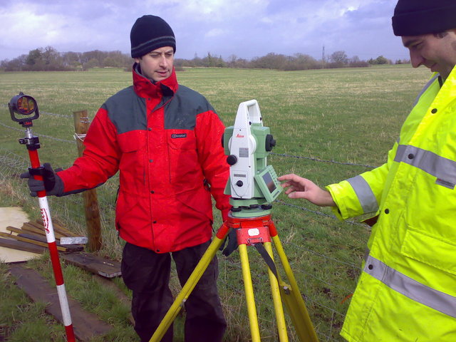
Finally we had a go with a total station, which is used to measure the distance and elevation between two points. If you know the location of the station and use a bit of trigonometry you can work out positions with a high degree of accuracy. For our use in the field this is functionally the same the as using the GPS systems except it requires two people to operate. One guy holds a pole with a target on top at the spot you want to get the coordinates for, the other aims the total station infrared beam at the target and takes a reading. We have used this kit before at Silchester and it’s use is kind of normal for an archaeological dig.